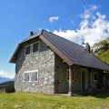
Casera di Val Dolce
Italy, Alpi Carniche, Croda Rossa/Trogkofel, Rattendorfer Schneid | 1 703 m
Map
Objects around


There was found 7 objects if you know any other, try to add it here...
 Main informations


Notes
For this object is not here yet no note, so if you know something, try to add it here...
Photogallery
1
© http://www.flickr.com/photos/elidoturco/4864459440/
(2012)
© www.boudy.info | all informations without guarantee | PHP 5.6.40-70+ubuntu20.04.1+deb.sury.org+1 | last change: 17.01.2022 19:41:24 V.A.